Monteliusvägen, Stockholm's Free Sunset Viewpoint: Complete Guide
Discover the Monteliusvägen Stockholm viewpoint: a free 500-meter cliffside path with skyline views, sunset timing, and winter safety tips.
On this page
Monteliusvägen Stockholm Viewpoint: Logistics, Timing, and Local Tips
Last updated July 2026, this guide maps out the Monteliusvägen Stockholm viewpoint in full: where to find its tucked-away entrances, which landmarks line up across the water, and when the light works best for photos. Perched along Södermalm's northern ridge, this quarter-mile cliffside walk delivers one of the city's most photographed panoramas without charging a krona for the privilege. Pair it with a longer wander through Södermalm to see why locals treat it as a daily ritual rather than a one-time photo stop.
What Is the Monteliusvägen Stockholm Viewpoint? (The Quick Answer)
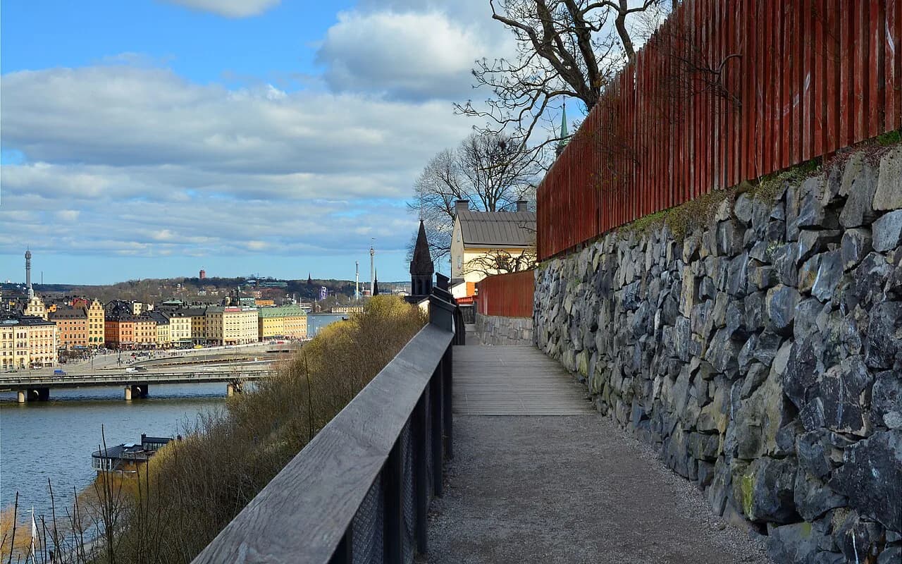
Monteliusvägen is a roughly 500-meter (quarter-mile) pedestrian path that runs along the top of a cliff on the northern edge of Södermalm, Stockholm's largest island district. It looks out over Lake Mälaren toward Stockholm City Hall, Riddarholmen, and the rooftops of Gamla Stan, with a metal safety rail separating walkers from the drop. The path itself costs nothing to visit and stays open around the clock, which is part of why it shows up on so many Free Things to Do in Stockholm: A 2026 Budget Guide lists. For a first look at how it fits into the city's wider collection of under-the-radar spots, the 10 Hidden Gems in Stockholm Locals Actually Visit guide is a useful starting point before narrowing in on this specific stretch of cliff.
Essential Logistics: Getting There and Finding the Entrances
The path is easy to miss because it runs above street level, tucked behind a row of residential buildings rather than fronting a main road. The most reliable entrance is the staircase off Bastugatan, which climbs up from the street to the elevated walkway; not every cross-street along the ridge connects directly, so Bastugatan is the point most walkers use to get up onto Monteliusvägen itself. Mariatorget, on the green T-bana line, sits closest to this stretch of Södermalm, though many visitors instead start from Slussen station and walk in, since Slussen is a major interchange and a natural jumping-off point for the surrounding Södermalm neighborhood guide area. Because the path sits directly above private homes, keep voices down, especially early morning or late at night, and stick to the marked walkway rather than cutting through residential courtyards. Anyone building a broader Södermalm itinerary around this walk can cross-reference the full Stockholm Neighborhoods Guide: Where to Stay and Explore in 2026 for how this ridge connects to the rest of the island.
The View: What Landmarks Can You See?
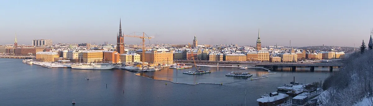
The view from Monteliusvägen stretches across Lake Mälaren toward Stockholm City Hall, easily the most recognizable landmark in the frame with its brick tower and twin gables. To the side, the small island of Riddarholmen and the spires of Gamla Stan (Old Town) complete the skyline, and on clear days Västerbron bridge is visible further along the water. Because the path runs in a straight line along the ridge, walkers get an unbroken 500 meters of sightlines rather than a single fixed lookout point, so the composition shifts gradually from one end to the other. Photographers chasing a quieter angle sometimes prefer walking the full stretch rather than stopping at the first opening in the railing, since crowds naturally cluster around the most obvious viewpoint near the middle. For more angles like this away from the main tourist track, the Secret Spots in Stockholm: Hidden Gems Locals Know guide rounds up comparable lookouts across the city.
Photographers seeking less-crowded compositions should avoid stopping at the obvious first viewpoint; walking the full 500-meter stretch offers fresh angles. Pair this with arriving after peak sunset—better light distribution and significantly fewer crowds competing for the railing.
Best Time to Visit: Sunrise, Sunset, and the Blue Hour
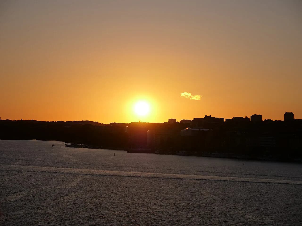
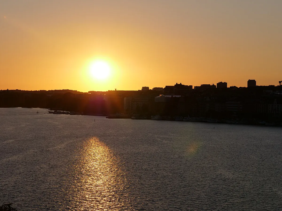
Sunset is generally the stronger choice for photographing Stockholm City Hall from Monteliusvägen, because the setting sun sits behind or to the side of the photographer, lighting up the building's red brickwork rather than leaving it in silhouette. Sunrise from the same spot faces the opposite problem: the light comes from behind City Hall, so the landmark reads as a darker outline against a brightening sky, a look some photographers prefer for mood but that works against a well-lit shot. The short window right after sunset, sometimes called the blue hour, is when the sky's residual color balances against the city's lights and tends to produce the most balanced exposures. Because Stockholm's daylight hours swing dramatically between seasons, it is worth checking a local sunset table before setting out rather than assuming a fixed time year-round, and building the visit around the wider best time to visit Stockholm guide if the goal is also to dodge peak crowds.
Seasonal Considerations: Winter Safety and Summer Crowds
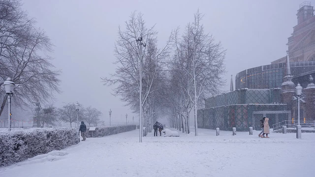
Winter is the season that demands the most caution on Monteliusvägen. The path is not always salted or sanded immediately after snowfall, and the sections of wooden boardwalk in particular can turn exceptionally slick with a thin layer of ice that is hard to spot underfoot. Sturdy, grippy footwear matters more here than on almost any other typical Södermalm walk, and it is worth slowing down rather than assuming the safety rail alone is enough protection on an icy surface. Summer brings the opposite problem: the popularity of the sunset view means the best stretch of railing can get genuinely crowded on clear evenings, particularly on weekends. Visiting slightly earlier than peak sunset, or picking a weekday, is the simplest way around this, and pairs well with the broader seasonal advice in the Off the Beaten Path in Stockholm: 2026 Local Guide guide for spreading visits away from the busiest hours.
Monteliusvägen vs. Skinnarviksberget: Which Viewpoint Is Better?
Skinnarviksberget sits close by on the same Södermalm ridge and is the natural comparison point, since both are commonly recommended together as the district's two standout lookouts. Monteliusvägen is a level, railed walkway running along the cliff edge, which makes it the more comfortable option for a relaxed walk, a stroller-friendly stretch in parts, or a slow photo session. Skinnarviksberget, by contrast, is an exposed rock outcrop rather than a paved path, with uneven natural terrain and no railing, so it suits visitors who want to scramble onto open rock for a wide, unobstructed view rather than a managed walkway. In our editorial assessment, Monteliusvägen wins for ease and reliability, especially with children, mobility concerns, or camera gear, while Skinnarviksberget appeals more to visitors comfortable with informal terrain who want to sit on open rock away from a fixed path. Many visitors reasonably do both in the same outing, since the two sit within walking distance of each other along the same ridge.
| Feature | Monteliusvägen | Skinnarviksberget |
|---|---|---|
| Terrain | Paved/gravel walkway with railing | Exposed natural rock, no railing |
| Best for | Strolling, prams in parts, photography | Sitting on open rock, wide views |
| Access | Level path along the cliff top | Informal scramble up rock |
| Crowd level | Busiest right at sunset | Generally quieter |
Planning Your Visit: Costs, Accessibility, and Facilities
There is no entrance fee for Monteliusvägen; it costs 0 SEK to walk, and the path stays open 24 hours a day as a public route rather than a ticketed attraction. That said, it is not a fully accessible route: while much of the walkway is level, some sections shift between gravel, cobblestone, and wooden boardwalk, which makes parts of the path slow going for wheelchairs and occasionally bumpy for strollers. There are no public restrooms, cafes, or facilities directly on the path itself, since it runs behind private housing, so plan to use facilities before arriving or afterward in Södermalm proper. Once the walk is done, the local restaurants in Stockholm guide is a practical next stop for finding somewhere nearby to eat or warm up, particularly after a cold-weather visit.
The path's mixed surface—gravel, cobblestone, wooden boardwalk—creates year-round accessibility challenges for wheelchairs and strollers. Winter intensifies this: boardwalk sections become slippery with ice that's hard to spot, making sturdy footwear essential and requiring extra caution or alternative timing.
Mistakes to Avoid When Visiting Monteliusvägen
A few recurring mistakes trip up first-time visitors to this stretch of Södermalm, most of them easy to avoid once you know the path's quirks.
- Assuming every cross-street leads onto the path — the Bastugatan staircase is the entrance most walkers rely on, and not every side street connects directly to the elevated walkway.
- Showing up right at sunset with no backup plan — the most photogenic stretch of railing fills up fast on clear evenings, so arrive with time to find a spot.
- Wearing smooth-soled shoes in winter — the boardwalk sections are not always salted or sanded right after snow, and they can be slicker than they look.
- Expecting to see the Northern Lights — Stockholm's latitude and city light pollution make aurora sightings from a viewpoint like this unrealistic; it's a skyline and lake view, not an aurora spot.
- Treating the path as a nightlife or hangout spot — it runs directly behind residential homes, so keep noise down, especially outside daytime hours.
What's Nearby: Exploring Södermalm After the View
Monteliusvägen sits within a short, walkable loop of other Södermalm landmarks worth folding into the same outing. Ivar Los Park runs along part of the same ridge and offers benches and green space to pause in before or after the viewpoint, while the steep lanes of Mariaberget below lead down toward Maria Magdalena Church, one of the older parish churches on the island. A simple route many visitors follow starts at Slussen, climbs up to Monteliusvägen, and finishes by dropping back down into Södermalm's streets for food or coffee, an easy way to turn a single viewpoint into a fuller half-day. For where to go next, the 9 Unique Things to Do in Stockholm: A Local's Guide to Hidden Gems (2026) guide and the local food guide both build naturally on this same corner of the island.
Frequently Asked Questions
Where do you start the Monteliusvägen walk?
Most walkers start from either Mariatorget or Slussen T-bana station and approach on foot, then join the elevated path via the staircase off Bastugatan, since the walkway sits above street level behind residential buildings rather than opening directly onto the main road.
Is Monteliusvägen free to visit?
Yes. There is no entrance fee or ticket required; the path is a public walkway open 24 hours a day at no cost.
Can you see the Northern Lights from Monteliusvägen?
Realistically, no. Stockholm's latitude and city light pollution mean aurora sightings from a viewpoint like this are not something to plan a visit around; Monteliusvägen is best known for its skyline and lake view rather than night-sky phenomena.
How long does it take to walk Monteliusvägen?
The path itself covers about 500 meters (a quarter mile), so walking it end to end is quick; most of the time on a visit goes toward pausing at viewpoints along the railing rather than the walk itself.
Is Monteliusvägen safe to walk at night or in winter?
The path is open around the clock and has a safety rail along the cliff edge, but winter conditions call for extra caution: sections, especially the wooden boardwalk, are not always salted or sanded right after snowfall and can get slippery. At night, stick to the lit, marked walkway and keep noise down, since the path runs directly behind residential homes.
Continue exploring
More guides you'll find useful