Venetian Lagoon: A Complete Guide to the Islands and Ecosystem
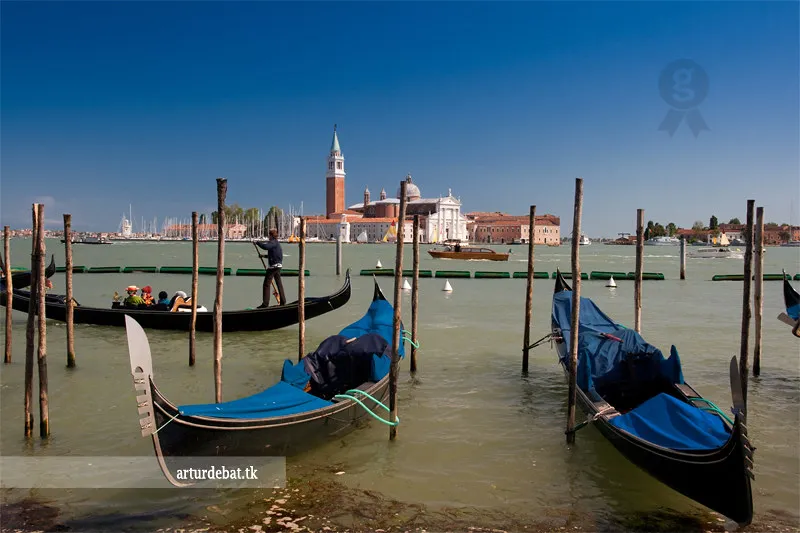
The Venetian Lagoon is a massive enclosed bay located in the Adriatic Sea. It covers about 550 square kilometres and protects the historic city of Venice. Most visitors only see the main canals, but the wider lagoon holds many secrets. Exploring these waters reveals a mix of ancient history, fragile marshland, and islands that have been inhabited, abandoned, and sometimes swallowed by the sea.
The History and Formation of the Venetian Lagoon
The lagoon formed about 6,000 years ago as sea levels rose after the last ice age. Rivers like the Brenta, Sile, and Piave deposited silt that created protective sandbars called lidi. These barriers gradually separated the shallow basin from the open Adriatic Sea, leaving three navigable inlets at Lido, Malamocco, and Chioggia. Early settlers found safety here from mainland invasions during the collapse of the Western Roman Empire in the 5th and 6th centuries.
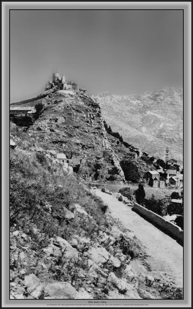
The Venetian Republic, known as the Dogado, managed these waters with extraordinary precision for centuries. Engineers diverted the Brenta and Sile rivers away from the lagoon between the 13th and 16th centuries to prevent silt from filling the basin. A special water authority called the Magistrato alle Acque was established in 1501 specifically to govern the lagoon's morphology. Even Marco Polo, writing his last will and testament, described Venice as a city whose domain stretched from Grado to Cavarzere — the full length of the lagoon.
Human intervention never stopped shaping the lagoon. From the 19th century, groundwater extraction for industry in the Mestre-Marghera complex caused significant subsidence, lowering Venice relative to sea level at roughly 1.5 mm per year between 1972 and 2002. That slow sinking, combined with rising Adriatic water levels, set the stage for today's flood management challenges.
The Lagoon Ecosystem and the MOSE Project
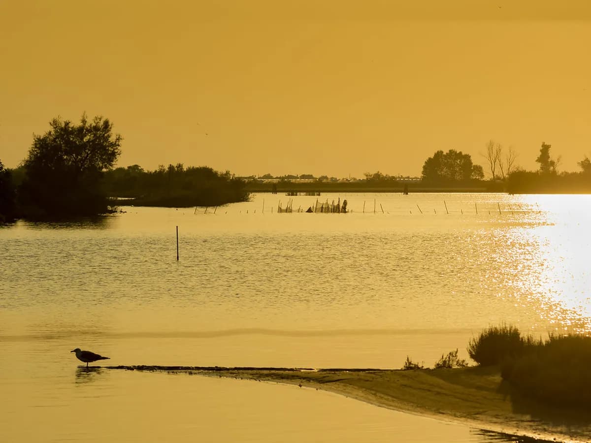
The Venetian Lagoon features a unique coastal environment defined by barene (salt marshes), tidal mud flats, and a dense network of dredged channels. About 80% of the lagoon surface consists of these shallow flats and marshes, with only around 11% forming permanent open water. The barene act as natural sponges, absorbing tidal energy and providing habitat for rare wading birds, migratory waterfowl, and brackish-water fish species. Background on the basin's geology and ecology is summarised in the Venetian Lagoon overview. You can learn more about ongoing scientific efforts through Venice International University, which coordinates lagoon research programs.
High tides known locally as acqua alta have threatened Venice for centuries. The most damaging events occur in autumn and winter when spring tides combine with the Scirocco wind from the southeast, pushing Adriatic water into the lagoon faster than it can drain. The historic flood of November 1966 reached 194 cm above sea level and accelerated political will for a permanent solution.
The MOSE Project is that solution — a system of 78 mobile flap barriers installed at the three lagoon inlets. The barriers sit flat on the seabed under normal conditions and rise to block the Adriatic when forecasts show water levels will exceed 110 cm above the standard reference datum. Since the system became operational in 2020, it has successfully activated dozens of times, preventing flooding in San Marco Square on multiple occasions that would otherwise have caused significant damage. The system is not without trade-offs: frequent closures reduce water exchange in the lagoon, which raises ecological concerns about water quality and sediment dynamics. Technical specifications and activation data are published by the official MOSE project.
Major Islands: Murano, Burano, and the Lido
The three most-visited islands sit along the northern and eastern edges of the lagoon and each developed a distinct identity that still defines them today. Understanding their individual characters helps you decide how much time to allocate to each, and whether the standard tour-boat itinerary or independent vaporetto travel suits you better.
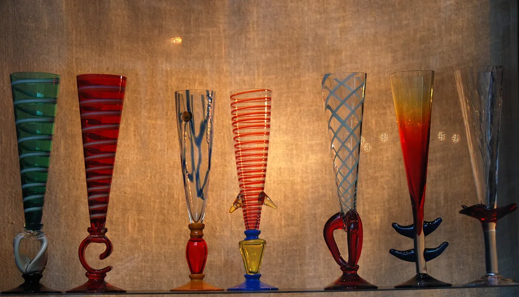
Murano lies just 1 km north of Venice and is reachable by vaporetto Line 4.1 or 4.2 in about 15 minutes from Fondamente Nove. In 1291, the Venetian Republic ordered all glassmakers to relocate here, fearing fire in the wooden city. That forced migration gave Murano a monopoly on high-quality glassmaking that lasted centuries. Today around 5,000 people live on the island and a handful of furnaces still produce work using 700-year-old techniques. Entrance to furnace demonstrations is free, though you are expected to browse the adjacent showroom. The best pieces are expensive; the cheap imports sold near the ferry stop are not Murano glass. Look for the Vetro Artistico Murano trademark on anything you buy.
Burano sits 10 km northeast of Venice, roughly 45 minutes by vaporetto Line 12 from Fondamente Nove. Its brightly painted houses — each colour registered with the local government — make it one of the most photographed places in the lagoon. See the Burano reference page for the colour-registration story. The island was historically a satellite of the older city of Torcello, and its 3,000 residents still maintain traditions of lacemaking that trace back to the 16th century. The Museo del Merletto (Piazza Galuppi; admission €5) documents the craft's history and displays surviving examples. Visit early morning, before 09:00, to photograph the streets without crowds from the tour boats that arrive by midday.
The Lido di Venezia is 16 km long and barely 1 km wide, separating the lagoon from the Adriatic. Unlike every other Venetian island, it has roads and cars. Vaporetto Line 1 covers the 25-minute crossing from San Zaccaria. The Lido functions as Venice's beach resort from June through September, and hosts the Venice Film Festival each September at the Palazzo del Cinema. Outside summer, it is simply a quiet residential strip — pleasant for a walk but not a major attraction in its own right.
| Island | Distance from Venice | Vaporetto Line | Journey Time | Main Draw |
|---|---|---|---|---|
| Murano | 1 km north | 4.1 / 4.2 | ~15 min | Glassmaking, Basilica di Santa Maria e San Donato |
| Burano | 10 km NE | 12 | ~45 min | Coloured houses, Museo del Merletto (lace) |
| Torcello | 10 km NE (via Burano) | 12 + Line 9 | ~50 min | Byzantine mosaics, cathedral founded 639 AD |
| Lido di Venezia | 4 km SE | 1 / 5.1 | ~25 min | Adriatic beach, Venice Film Festival |
| Sant'Erasmo | 6 km NE | 13 | ~30 min | Farmland, violet artichokes, cycling |
| Mazzorbo | 10 km NE | 12 | ~45 min | Venissa wine estate, Santa Caterina church |
Islands of the Northern Lagoon: Torcello, Sant'Erasmo, and Mazzorbo
Torcello was the first major city in the lagoon, settled in 452 AD and powerful enough to house a cathedral and bishops before Saint Mark's Basilica existed. At its peak it may have held 10,000 inhabitants; today fewer than 20 people live there permanently. What remains is the Basilica of Santa Maria Assunta (founded 639), whose 11th-century Byzantine mosaics depicting the Last Judgement are among the finest in Italy, and the smaller 11th-century church of Santa Fosca. The walk from the vaporetto stop across the meadow to the basilica — past the Devil's Bridge and along a quiet canal — takes about ten minutes and is itself worth the trip. Our full guide to Torcello's history and what to see covers the island in depth.
Sant'Erasmo is the largest island in the lagoon by area — bigger than Murano — but with only around 500 inhabitants. Known as the orchard of Venice, it supplies local restaurants with its famous violet artichokes (carciofi violetti), which appear at markets in spring. The Torre Massimiliana, a fortified tower built by the Austrians after Napoleon's defeat, sits in ruins near the northern tip. The island contrasts sharply with the industrial glass-making atmosphere of Murano: this is farmland, cycling paths, and silence. Vaporetto Line 13 from Fondamente Nove stops here.
Mazzorbo adjoins Burano by a footbridge and is often overlooked by visitors who step off the vaporetto and walk straight toward Burano's coloured houses. That's a mistake. Mazzorbo is one of the oldest settlements in the lagoon — Mycenaean pottery found here in 1881 suggests commercial activity as far back as 1600 BC. The beautiful Gothic church of Santa Caterina dates from the 1300s. The island also contains the Venissa wine estate, where a small vineyard produces a rare golden wine from the almost-extinct Dorona di Venezia grape; a meal or tasting here is one of the lagoon's more unusual experiences. Vaporetto Line 12 stops directly at Mazzorbo before continuing to Burano.
San Francesco del Deserto: The Island No Vaporetto Reaches
San Francesco del Deserto sits in the northern lagoon between Burano and Sant'Erasmo, and no public transport serves it. That inaccessibility is the point. A Franciscan monastery has operated here since 1228, when St Francis of Assisi allegedly stopped on this island on his return from a pilgrimage to the Holy Land. The Michiel family, who owned the island, later donated it to the Order.
To visit, you hire a private rowing boat from Burano — local fishermen offer the crossing for around €20–25 return, negotiated at the waterfront. The monks ask that you arrive by 09:00 or 14:00 for one of their guided tours, which last about an hour and include the cloisters, the original cell where Francis is said to have stayed, and the lagoon-facing garden. Admission is free, though a donation is expected. Groups of more than ten should contact the monastery in advance. This is not a place to arrive at unannounced mid-afternoon. The quiet and the view across the reed beds toward Burano are unlike anything else in the northern lagoon.
This combination — no vaporetto, monk-led visits at fixed hours, a tiny rowing boat crossing — filters out virtually all day-trippers. If you want genuine solitude in the Venetian Lagoon without travelling to an abandoned island, San Francesco del Deserto is the answer. Check the map of Venice canals and neighborhoods to orient yourself before planning the Burano-to-monastery crossing.
Islands of the Southern Lagoon: Pellestrina and Chioggia
Pellestrina is a long, thin strip of land — 15 km by roughly 1 km — that separates the southern lagoon from the Adriatic Sea. It has only a few hundred inhabitants spread across several small fishing villages, connected by the lagoon's only long straight road. The dominant feature is the Murazzi, massive sea walls of Istrian stone built in the 18th century under the Venetian Republic to resist wave erosion. They run for kilometres along the seaward side and remain among the most impressive civil engineering works from that era in the region. The atmosphere here is unhurried in a way that Burano, with its tour groups, no longer is. Getting there requires a vaporetto from Venice to the Lido, a bus down the length of the Lido, and then a ferry across to Pellestrina — budget two hours each way. Check Venezia Unica for current ferry schedules.
Chioggia anchors the southern tip of the lagoon and operates as a functioning port city with about 50,000 inhabitants. It has its own canals, bridges, and a fish market that opens daily before dawn and is among the most active on the Adriatic. Unlike Venice, Chioggia has cars and a tangible working-class economy built around fishing and trade. Several medieval churches survive, and the 12th-century bell tower of Sant'Andrea houses one of the oldest working clocks in the world. Chioggia is accessible by bus from Mestre or by boat from the Lido area. It offers a more lived-in version of the lagoon experience than the central islands.
The "Lost" and Inaccessible Islands of Venice
Several islands have disappeared entirely, visible now only in medieval documents and underwater archaeology. San Marco in Boccalama was a functioning town in the central lagoon whose location was completely unknown until archaeologists rediscovered it a few decades ago. Excavators found the remains of two ships from the 1500s in the mud — one appears to be a Venetian war galley, which would make it the only example known. A modern iron wall now surrounds the site to prevent further erosion of the sediment hiding these objects.
Ammiana and Costanziaco were thriving religious and commercial centres in the northern lagoon during the early Middle Ages. Rising water levels and repeated outbreaks of malaria eventually forced the residents to flee, and the islands were gradually reclaimed by the lagoon. Today only underwater ruins and occasional stone fragments remain. Visiting these sites is not practical without a private boat and specialist knowledge of the mud flats.
Other islands are simply abandoned rather than lost. San Giorgio in Alga, Sant'Angelo della Polvere, and Madonna del Monte are all visible from the water but inaccessible to the public, either because they are in private hands or because the structures are dangerously derelict. They are a reminder that the lagoon is not static — human presence here has always been conditional on the balance between silt, tide, and political will.
Poveglia: History and Modern Constraints
Poveglia is often reduced to "haunted island" in travel content, but its actual history is more interesting and more instructive. It was a medieval town in the southern lagoon, destroyed during the War of Chioggia (1379–1380). The Venetian Republic did not allow the population to return, and the island became a naval maintenance depot. In the late 18th century it was repurposed as the Lazzaretto Nuovissimo, a quarantine station for the black plague, replacing the older Lazzaretto Vecchio. The original Venetian lazaret system — one of the world's first organised quarantine networks — is documented in detail on Venetian Stories.
After the quarantine use ended, Poveglia housed a civilian hospital for skin and respiratory diseases, then a psychiatric hospital, before being abandoned in the 1960s. The Italian state owns the island but has been unable to agree on a use for it. A group of around 5,000 Venetians called Poveglia per tutti each contributed €99 to bid on a 99-year concession, hoping to create a communal space — the bid failed, as did all other bids. The island is currently closed to the general public. Entering without permission is illegal and carries significant fines. It is visible from the vaporetto between Venice and the Lido.
Exploring Sant'Elena and San Michele
Sant'Elena occupies the eastern tip of the main Venice island group and is technically part of the Castello sestiere. It was originally a separate island joined to the rest of Venice in the 1920s by landfill. The neighbourhood is genuinely residential — parks, a small football stadium, and apartment buildings used by people who actually live in Venice. It is one of the few places in the city where you can sit on a bench without being surrounded by tourists. Vaporetto Lines 1, 5.1, and 6 all stop here.
San Michele is the cemetery island, sitting between Venice and Murano about a five-minute boat ride from Fondamente Nove. The cemetery opened in 1807, when French occupation authorities decreed that burial in the city was unsanitary. The island was formed by joining two earlier islands, San Michele and San Cristoforo, by filling in the canal between them. Igor Stravinsky, Ezra Pound, and Sergei Diaghilev are among the notable figures buried here. The cemetery is open daily from 07:30 until one hour before sunset. Dress modestly and keep noise down — it remains an active burial site. Vaporetto Lines 4.1 and 4.2 stop at the island's dedicated jetty.
Giudecca and the Southern Waterfront
Giudecca is a long, narrow island directly south of the main Venice island, separated by the Giudecca Canal — one of the broadest waterways in the lagoon and the main cruise ship route into the city. Historically it was the location of grand private gardens and palaces belonging to Venetian aristocracy. In the early 20th century those gave way to factories and shipyards, which defined the island's working-class character for decades. Most industry has since closed, and Giudecca today is primarily residential, quieter and cheaper than the sestieri facing it across the canal.
The Redentore church on the Giudecca waterfront is one of Palladio's masterpieces, built in 1577 to mark the end of a plague outbreak. Each July the Festa del Redentore involves a pontoon bridge built across the Giudecca Canal so that Venetians can walk across to the church — the one night of the year when the waterway is pedestrianised. Vaporetto Line 2 and the Giudecca ferry cross from Zattere in under five minutes.
Planning a Day Trip in the Lagoon
The most efficient lagoon day trip combines Murano, Mazzorbo, and Burano as a single run on vaporetto Line 12 from Fondamente Nove. The line stops at Murano Faro (45 minutes for the furnaces), then continues to Mazzorbo (15 minutes at Santa Caterina and the Venissa vineyard), then Burano (90 minutes minimum). The last Line 12 departure from Burano back to Venice is typically around 21:00 in summer — confirm current schedules on the ACTV website before you travel. A standard vaporetto ticket costs €9.50 per single ride; a 24-hour pass at €25 makes more sense if you plan multiple crossings.
Adding Torcello extends the trip by about 90 minutes. The Line 9 ferry connects Burano to Torcello every 30 minutes during the day, with a journey time of around 10 minutes. The basilica admission is €5. Torcello has only one restaurant and a small bar — plan lunch at Burano or bring food if you intend to spend serious time at the basilica. The combination of Burano and Torcello represents the northern lagoon at its best: colour and craft on one island, silence and mosaics on the other.
A standard vaporetto single ticket costs €9.50 in 2026; a 24-hour pass at €25 makes more sense if you plan multiple island crossings. Avoid agency tours from St Mark's Square — the public Line 12 covers the same route for a fraction of the cost and lets you control your own schedule.
Avoid booking combined Murano-Burano-Torcello tours from agencies in St Mark's Square. These trips are overpriced and give you inadequate time on each island. The public vaporetto covers the same route for a fraction of the cost and lets you control your own schedule. If you are staying in Cannaregio, you are already walking distance from Fondamente Nove, which is the main departure point for northern lagoon services.
Why is Venice a Pedestrian City?
Venice lacks cars because its foundations are built on millions of wooden piles driven into the lagoon mud. The narrow streets, or calli, were never designed for wheeled traffic — they evolved as pedestrian paths between buildings constructed on separate mudflat islands. Bridges are often steep-stepped and too narrow for anything broader than a handcart. This layout is a direct consequence of the lagoon's estuarine geography, which made it faster and cheaper to move goods by boat than by road from the city's founding through to the present day.
Poveglia island is currently closed to the general public — unauthorized entry is illegal and carries significant fines. It is visible from the vaporetto between Venice and the Lido but cannot be landed on without official permission.
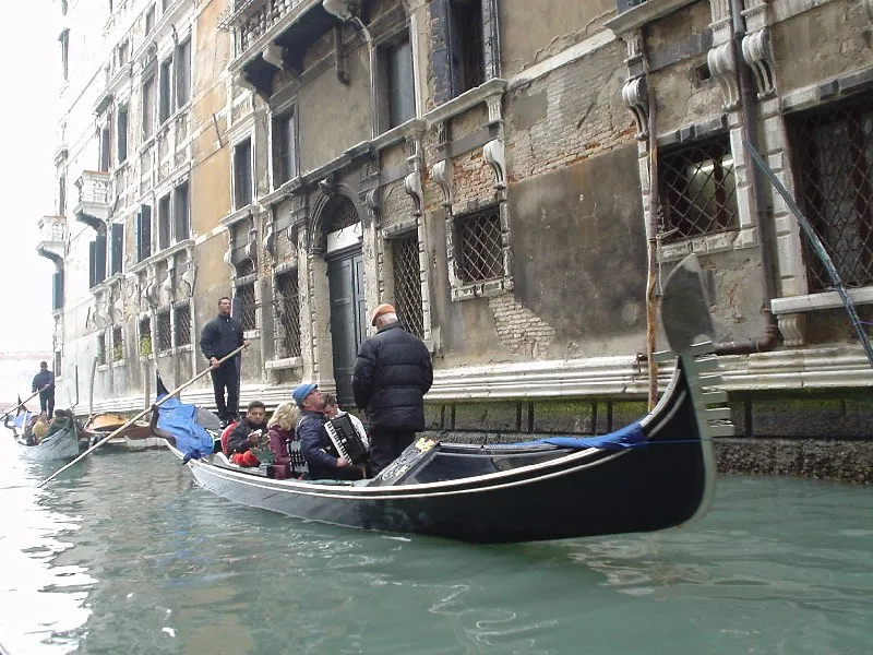
The water-based transport system replaced the need for roads entirely. The vaporetto network serves as the city's bus system; private water taxis function like cabs; gondolas once handled the kind of short personal ferries that trams cover in other cities. Walking is the only way to reach most addresses and to discover the non-touristy things to do in Venice that lie beyond the main tourist corridors. The absence of engine noise from cars is one of the genuinely distinctive qualities of life in Venice — and one that disappears the moment you cross the bridge to Mestre.
Frequently Asked Questions
How many islands are in the Venetian Lagoon?
The lagoon contains approximately 118 islands of various sizes. Some are densely populated urban centers like Venice, while others are tiny, uninhabited mudflats or salt marshes. You can explore many of these via the public vaporetto system.
Can you visit Poveglia island?
No, Poveglia is currently closed to the general public for safety and legal reasons. The island is considered dangerous due to crumbling buildings and its history as a quarantine station. Unauthorized entry can result in heavy fines from local authorities.
What is the MOSE project in Venice?
The MOSE project is a massive engineering system designed to protect Venice from flooding during high tides. It consists of mobile barriers at the lagoon's three inlets that rise to block the Adriatic Sea. It has successfully prevented several acqua alta events.
Which lagoon islands are best for a day trip?
The most popular day trip includes the trio of Murano, Burano, and Torcello. Murano is famous for glass, Burano for its colorful houses, and Torcello for its ancient history. These islands are easily reachable using a single day-pass for the water bus.
Why is Venice a pedestrian city?
Venice is a pedestrian city because its foundations were built on marshy islands separated by water. The narrow streets and numerous bridges make it impossible for cars to navigate. This unique geography forced the city to rely on boats and walking for centuries.
The Venetian Lagoon is far more than just a backdrop for the city of Venice. It is a living ecosystem with a rich history that spans thousands of years. From the glass of Murano to the quiet marshes around San Francesco del Deserto, every island tells a different story. Take the time to venture beyond the Rialto and discover the true depth of this region.
For the wider city context, see our complete hidden gems in Venice guide.