Off the Beaten Path in Salzburg (2026): Local Streets, Trails, and Beer Halls
A 2026 guide to off the beaten path in Salzburg: Steingasse, Kapuzinerberg, Gaisberg, and local beer halls, with bus numbers, trail times, and euro prices.
On this page
Off the Beaten Path in Salzburg: Local Streets, Trails, and Beer Halls
Last updated August 2026, this guide covers what's actually off the beaten path in Salzburg, from the Kapuzinerberg ridge to the beer garden in Mülln. Locals hike Gaisberg and walk Steingasse on weekday afternoons, not as tourist checkboxes. Each section below pairs a specific route or address with a bus number, a euro price, and a realistic time commitment.
Off the Beaten Path in Salzburg: Quick Comparison
Mirabell Gardens and Mozart's Birthplace fill guidebooks for a reason, but treat them as optional stops rather than the main event here. Five spots below split into two groups. One group covers short detours inside the city. Another covers half-day or full-day escapes into the hills and valleys beyond it. For a broader list of low-key attractions, see the 11 Hidden Gems in Salzburg Beyond the Getreidegasse Crowds guide. A companion guide, Secret Spots in Salzburg: A 2026 Guide to Quiet Corners Locals Use, covers more ground still. Free-only picks live in a separate Free Things to Do in Salzburg: A Practical Budget Guide guide. Activity-specific picks sit in the 10 Unique Things to Do in Salzburg, Austria (2026 Guide) list. Schloss Hellbrunn's trick fountains are worth a visit too, but they draw a steady tour-bus crowd of their own. Ticket and timing details sit in the Schloss Hellbrunn guide, covered separately from this list. That comparison appears in the table below, ranking five spots by time, effort, and cost, with an editorial effort scale rather than an official difficulty rating.
| Spot | Access | Time Required | Effort | Cost |
|---|---|---|---|---|
| Steingasse | 5-minute walk from the Mozartsteg footbridge | 30-45 min | Easy | Free |
| St. Peter's Cemetery & Catacombs | Inside the Altstadt, next to St. Peter's Abbey | 20-30 min | Easy | Free cemetery, small fee for catacombs |
| Augustiner Bräustübl | Mülln district, on foot from the Altstadt | 1-2 hours | Easy | Price of beer and food only |
| Kapuzinerberg to Hettwer Bastei | Stations of the Cross path near Linzergasse | 45-60 min round trip | Moderate | Free |
| Gaisberg summit | Bus 151 from Mirabellplatz, or on foot from the center | 30-40 min by bus, about 3 hrs on foot | Easy by bus, moderate to strenuous on foot | Under €10 by bus, free on foot |
Quiet Corners in the Old Town and Nearby Neighborhoods
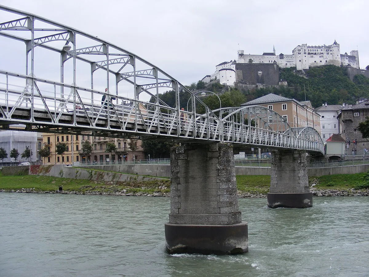
Cross the Mozartsteg footbridge from the Altstadt side, and Steingasse opens up on the far bank, tucked behind Linzergasse. Where Getreidegasse funnels tour groups past souvenir shops, Steingasse stays narrow, cobbled, and mostly local. A full walking route through the street is mapped in the Steingasse guide. Cobblestone side streets climb gently past centuries-old townhouses toward the base of the Kapuzinerberg ridge. From there, the Stations of the Cross path switchbacks up to Hettwer Bastei, a stone bastion on the ridge above the Altstadt. Budget roughly 45 to 60 minutes for the round trip, and wear sneakers rather than sandals, since sections of the path stay uneven. Full route detail, including the exact turns, sits in the Kapuzinerberg guide. St. Peter's Cemetery sits inside the Altstadt next to St. Peter's Abbey, and it draws a fraction of the crowd gathered at the fortress above it. Its catacombs are carved into the cliff face, with sections dating to the 12th century, and a small entry fee covers access to the chambers. Old tombstones make the cemetery worth 20 to 30 minutes, especially early morning before tour buses arrive. Almkanal Surfwelle is a standing river wave near Leopoldskron, an easy walk from Nonntal. Local surfers use it from spring through autumn, and weekend afternoons draw a real crowd of spectators and riders, so this is one spot where hidden does not mean empty. Weekday mornings are the quieter window for watching without the audience. Skipping the Mönchsberg funicular is another way to avoid both a line and a fare. The funicular costs €3.40 one-way or €4.80 return; walking the same route costs nothing but time. Instead, climb on foot from Mülln or from Nonntal, following the marked paths locals use as a neighborhood shortcut rather than a tourist route up to Hohensalzburg Fortress.
Steingasse's 30-45 minutes of cobbled streets and galleries work as a standalone quiet walk or as the start of a rainy-day loop toward Augustiner Bräustübl's indoor beer hall.
- Steingasse: free, reached via the Mozartsteg footbridge, about 30-45 minutes end to end.
- Kapuzinerberg to Hettwer Bastei: free, Stations of the Cross path near Linzergasse, 45-60 minutes round trip, sneakers recommended.
- St. Peter's Cemetery and Catacombs: cemetery free, small entry fee for the catacombs, 20-30 minutes.
- Almkanal Surfwelle: free to watch, near Leopoldskron and an easy walk from Nonntal, busiest on weekend afternoons spring through autumn.
Where Locals Actually Eat and Drink
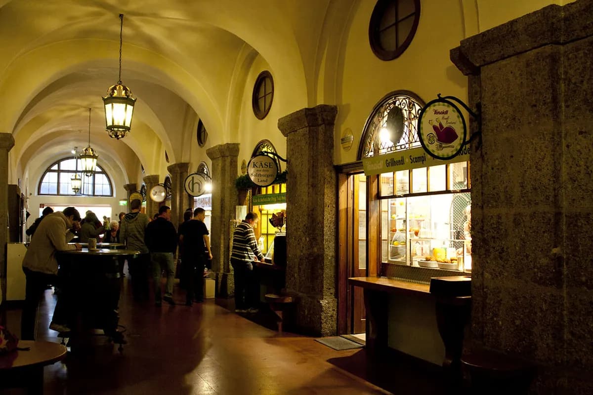
Augustiner Bräustübl in Mülln has poured beer since 1621, and its self-service system surprises most first-time visitors. Buy a stein at the counter, rinse it at the fountain, and carry it to a serving window where staff fill it straight from wooden kegs. Food works the same way: bring your own, or buy from the pretzel and rotisserie stalls inside the courtyard. It's regularly described as one of Austria's largest beer gardens, though it functions as a local habit rather than a tour-bus stop. Shaded chestnut trees cover the courtyard, which fills with regulars most evenings. Full address and hours sit in the Mülln Augustiner Bräustübl guide. Stiegl-Brauwelt, the brewery museum on Bräuhausstraße, sits about 1.5 kilometers from Schloss Leopoldskron. It walks visitors through the brewing process floor by floor, with a tasting included at the end. Pair it with a walk through nearby Leopoldskron for a half-day loop that most Altstadt-only visitors skip entirely. Nonntal, just south of the Altstadt across the Salzach, reads as a working neighborhood rather than a postcard district. Student housing, small galleries, and neighborhood cafes line its side streets. It also functions as the walking approach to both Mönchsberg and the Almkanal. A dedicated Nonntal neighborhood guide maps the district in full. A separate Salzburg Neighborhoods Guide: Which Area Is Right for You? puts it in context against Mülln, Riedenburg, and the rest of the city. For food away from Getreidegasse, check the 8 Best Local Restaurants in Salzburg: Where to Eat Like a Local list. The Salzburg Local Food Guide: What to Eat, Where, and What to Skip goes deeper still, covering dishes rather than addresses.
- Augustiner Bräustübl: self-service, bring your own food, open year-round, Lindhofstraße 7 in Mülln.
- Stiegl-Brauwelt: brewery museum and tasting, about 1.5 km from Schloss Leopoldskron, open year-round.
- Nonntal: no ticket needed, about a 15-minute walk from the Altstadt.
Half-Day and Full-Day Escapes Into Nature
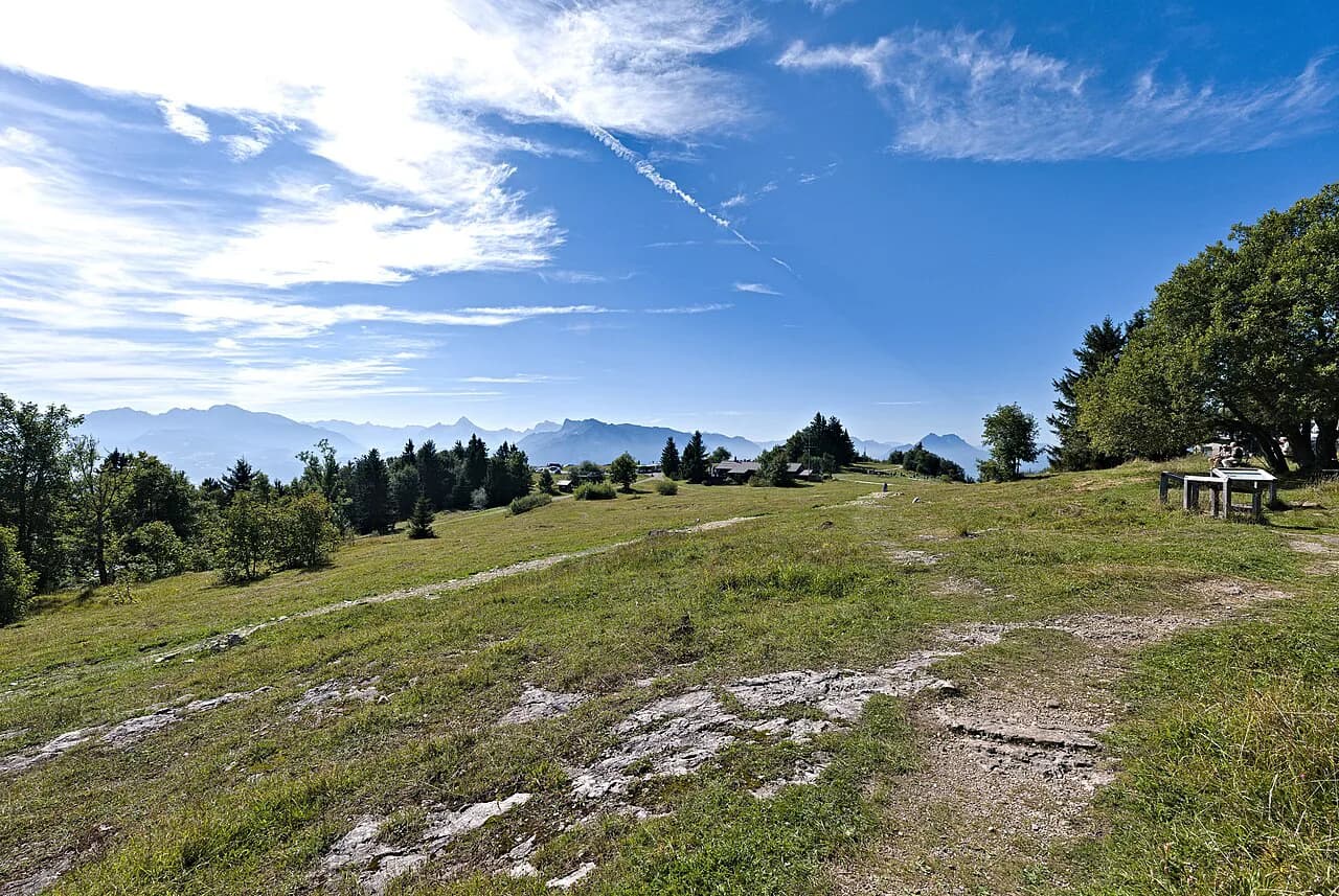
Three routes cover most of what's genuinely rural within reach of the city center: Gaisberg mountain, Bluntautal Valley, and the Königsseeache river. Additional options beyond these three sit in the 8 Best Day Trips From Salzburg: How to Choose, Get There, and Avoid the Crowds guide. Gaisberg rises directly behind the Schallmoos and Gnigl districts, and it's the only one of the three reachable entirely on foot. Its most direct trailhead starts at Eichstraße 66 in Gnigl, where stairs beside the house lead into marked forest paths. Walking from the Altstadt to the 1,300-meter summit takes roughly 3 hours, and the climb needs nothing more than sturdy sneakers outside winter snow. About 30 minutes below the top, the Rundwanderweg circular trail branches off. It's flat and takes about an hour, and it also works as a shorter loop if the full summit push feels like too much. Bus 151 runs from Mirabellplatz to the summit for under €10 one-way. It also stops at Zistelalm, roughly a 30-minute walk below the top on a steeper stretch of trail. Another trailhead starts in Parsch, reached by Bus 6 to the Ludwig-Schmederer-Platz terminus, then a 2-minute walk to the Judenbergweg path. Most hikers descend by bus rather than on foot, especially with tired knees. Weekday crowds stay thin even in summer, since the mountain draws mostly locals. Full route detail, including both trailheads, sits in the Gaisberg guide. Bluntautal Valley sits near Golling, reached by the S3 regional train toward Schwarzach St. Veit. Get off at Golling-Abtenau, then walk about 45 minutes to the small bridge marking the valley entrance. A one-way ticket ran €7 as of the most recently published fare; confirm the current price at the station's ticket machine, since regional fares shift year to year. Walking into the valley is flat and takes about an hour, passing two small lakes along the way. Bärenwirt, the only restaurant inside the valley, sits near the far end and is worth a stop for a meal before continuing. Past Bärenwirt, another 1.5 kilometers leads to a waterfall where most walkers turn back. The full loop runs close to 3 hours round trip. Hoher Göll, a 2,500-meter peak, rises above the valley and stays visible for most of the walk, though climbing it requires separate preparation well beyond a casual visit. Experienced hikers can continue across the German border toward Berchtesgaden on a marked route that runs about 25 kilometers and takes 8 to 10 hours total. This stretch needs an early start and full trail preparation. Königsseeache is a river near Rif, a small settlement between Hallein and central Salzburg. It functions as a local swimming spot rather than a hiking destination. Cyclists reach it in about 30 minutes along the Salzach River path. Bus 170 or 175 from Mirabell square also runs to Rif. The S3 train stops at Puch Urstein on the opposite bank, with a footbridge crossing to the swimming area. Open fires and overnight camping are no longer permitted along the riverbank, following past noise complaints from neighbors. A sandy stretch near Rif suits swimmers better than the stonier banks closer to where the river meets the Salzach. Summer afternoons draw a real local crowd, while winter visits mean a quiet riverside walk instead of a swim. This is a different destination from Lake Königssee near Berchtesgaden. Border-crossing logistics for that lake live in the separate Königssee day trip guide. For a lake option without the border crossing, the Fuschlsee guide covers another spot outside the city.
Gaisberg bus saves three hours compared to walking—choose the 30-40 min by bus, about 3 hrs on foot option to fit both the summit and quieter Kapuzinerberg or Augustiner Bräustübl into one day.
- Gaisberg: free on foot, or under €10 by Bus 151 from Mirabellplatz; sneakers are enough outside winter snow.
- Bluntautal Valley: roughly €7 one-way by S3 train to Golling-Abtenau, plus a 45-minute walk to the trailhead; flat terrain, no special gear needed.
- Königsseeache: free, reached by bike, Bus 170/175, or the S3 to Puch Urstein; best for summer swimming, quiet for winter walks.
A Rainy-Day Off-the-Path Itinerary
Grey skies are common enough in Salzburg that an indoor backup plan pays off. Start at Steingasse, where covered doorways and small galleries make for a decent walk even in drizzle. From there, head to Augustiner Bräustübl in Mülln. The beer hall itself is a full indoor space, tables included, so weather changes nothing about the visit. A third option is the Panorama Museum, which houses historical panoramic paintings entirely indoors. Confirm current hours before visiting, since museum schedules shift with the season. Stiegl-Brauwelt is another indoor option worth folding into a wet-weather day, and its brewery tour and tasting run rain or shine.
Planning Logistics: Getting Around, Costs, and Timing Mistakes
A single day covers the off-path spots in this guide comfortably, especially with one or two nature escapes plus a neighborhood walk. Adding Hallstatt to the same day as Salzburg's back streets and Gaisberg is the most common overreach. Both destinations reward unhurried time, and rushing between them tends to shortchange both. Most shops and many restaurants close on Sundays, including some inside the Altstadt, so plan grocery runs and souvenir shopping for Saturday or a weekday instead. For getting around, weigh the hop-on-hop-off bus against a multi-day Salzburg Card rather than buying single tickets for every stop. Current 2026 pricing for both options appears below. The card bundles public transport with entry to paid sights, while the hop-on-hop-off ticket covers transport between stops only. Standard per-ride fares apply for city buses alone, so tally planned stops before deciding which option costs less for the day. Drivers can park at Altstadtgarage, a garage cut into the rock near the Altstadt, for €3.60 per hour as of 2026. Timing the whole trip around fewer crowds is its own planning question, covered separately in a dedicated visiting Salzburg without crowds guide.
- Salzburg Card, 24 hours: €35 low season (Nov-Mar), €38 high season (Apr-Oct), as of 2026.
- Salzburg Card: 48- and 72-hour options also available.
- Hop-on-hop-off yellow line: stops near several spots in this guide, including roughly 1-1.5 km from Augustiner Bräustübl and 1.5-2 km from Stiegl-Brauwelt.
- Altstadtgarage parking: €3.60 per hour as of 2026, short walk to the Altstadt.
Frequently Asked Questions
Where can you find off the beaten path day trips from Salzburg?
Gaisberg mountain, Bluntautal Valley near Golling, and the Königsseeache river near Hallein cover the three most accessible nature escapes. Each is reachable by public transport in under an hour, and none requires a car.
How do you get to Gaisberg Mountain by bus?
Bus 151 leaves from Mirabellplatz and runs to the summit for under €10 one-way. It also stops at Zistelalm, about a 30-minute walk below the top on a steeper stretch of the Rundwanderweg trail.
Is Hohensalzburg Fortress worth visiting despite the crowds?
Hohensalzburg Fortress draws heavy crowds, and the funicular line can run long at midday in summer. Visiting early morning or booking tickets in advance cuts most of the wait. For a quieter alternative, the Kapuzinerberg climb to Hettwer Bastei offers a view over the city with far less foot traffic.
Where can you find local restaurants away from Getreidegasse?
Nonntal and Mülln hold most of the neighborhood spots locals actually use, away from the souvenir-shop stretch of Getreidegasse. Both neighborhoods are covered in more detail in the sections above.
Is Almkanal Surfwelle a quiet spot or a local hotspot?
It's a local hotspot rather than a quiet secret, especially on weekend afternoons between spring and autumn when surfers and spectators both show up. Weekday mornings are the quieter option if a crowd-free visit matters more than watching a full session.
How do you get to Bluntautal Valley by train from Salzburg?
Take the S3 regional train toward Schwarzach St. Veit and get off at Golling-Abtenau. From the station, it's about a 45-minute walk to the small bridge marking the valley entrance. The walk into the valley itself is flat and takes roughly another hour.
What should you wear for the Gaisberg and Kapuzinerberg hikes?
Sturdy sneakers cover both routes outside of winter. Gaisberg's main trail from Eichstraße 66 climbs steadily but stays on a clear forest path. The Kapuzinerberg route to Hettwer Bastei is shorter and no more technical, though both turn slick after rain.
Continue exploring
More guides you'll find useful