Torricelle Hills Verona Hiking: Best Trails, Routes & Viewpoints
Hike the Torricelle hills above Verona: trail routes, the Maximilian Towers, funicular vs. staircase access, and sunset views from Castel San Pietro.
On this page
Hiking the Torricelle Hills in Verona: Trails, Routes, and Viewpoints
Last updated August 2026, this guide covers torricelle hills verona hiking routes for travelers based in Verona's historic center. Rising directly north of Veronetta, the Torricelle sit an easy 15-minute walk from Ponte Pietra, climbing to 318 meters near Mount Ongarine. Trails range from an easy Castel San Pietro loop to a moderate half-day route through the Maximilian Towers and Avesa valley olive groves.
What Are the Torricelle Hills? A Quick Answer
Torricelle hills enclose Verona from the north, rising directly above the Veronetta district. Four cylindrical watchtowers built by the Austrian army between 1837 and 1843 on the Santa Giuliana ridge gave the area its name. Geographically, the Torricelle form the southern edge of the Lessini Mountains, wedged between the Valpolicella and Valpantena valleys. City limits stretch from the hamlet of Parona in the west to the Borgo Venezia district in the east. Several named hills and narrow valleys, locally called vaj, fill the space between. From Ponte Pietra, the walk into open countryside takes well under 15 minutes, which is the detail most city guides skip. In our editorial assessment, few short city walks anywhere in Italy end this quickly in open countryside. Difficulty ranges from an easy, mostly flat ramparts walk to a moderate half-day loop with real elevation gain.
Getting to the Trailhead from Ponte Pietra and Veronetta
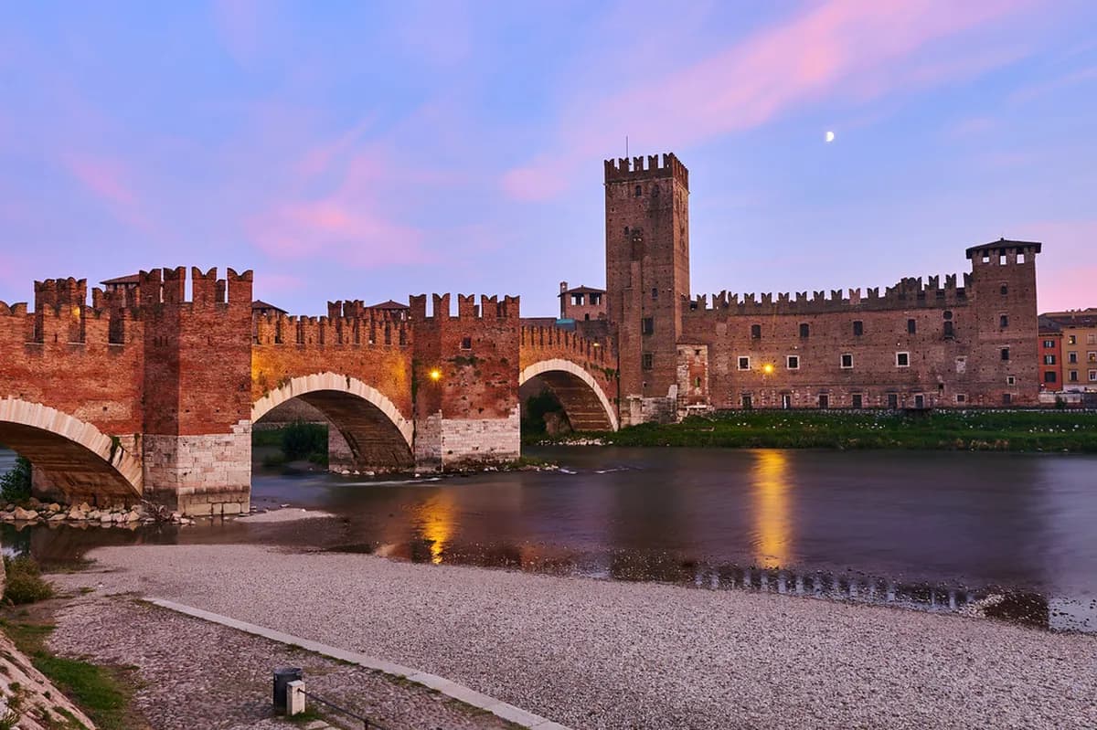
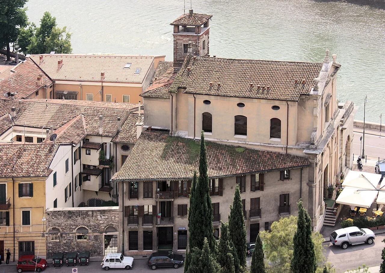
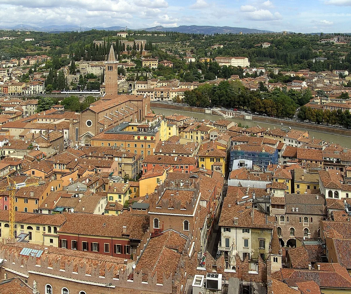
Start at Ponte Pietra, the stone bridge that crosses the Adige River into Veronetta. Veronetta's streets narrow into cobblestone lanes before the funicular station, a preview of the steeper terrain above. Local guidance from Visit Verona's official Torricelle guide recommends this exact crossing as the gateway to the hills. Two options lead up to Castel San Pietro, the first panoramic stop on most routes. A funicular runs from a station near the bridge and reaches the castle terrace within minutes. Parallel to it, a staircase climbs the same slope on foot, with landings that double as photo stops over the rooftops below. Climbing the stairs costs nothing. Free activities like this hike fill Verona's free things to do list. Funicular tickets are sold at the base station, and posted hours shift by season, so confirm the day's schedule and fare before you ride.
- Funicular: departs near Ponte Pietra, reaches Castel San Pietro in a few minutes, ticket required, hours shift by season.
- Staircase: same starting point, free to climb, several landings for photos over the rooftops.
Torricelle Hills Verona Hiking Routes: Four Trails to Try
Four named routes cover the main reasons hikers come to the Torricelle. Options include Austrian-era fortifications, a ridge walk along the old city walls, a pilgrimage site, and working olive groves. Each route starts within a short walk of the city center, which is rare for hill hiking this close to a historic core. Signage varies by route, so downloading an offline map before you start is worth the two extra minutes. Pick one route, or link two together if time allows.
The Avesa route demands 4+ hours to reach Mount Ongarine's 318 meter summit, making it significantly longer than any ridge walk through Austrian towers, which takes 2 to 3 hours.
- Maximilian Towers Loop: This route follows Via Santa Giuliana past all four Austrian watchtowers, built between 1837 and 1843. The towers sit at staggered elevations, roughly 269 to 312 meters, along Via Torricelle and Via Bonuzzo Sant'Anna. They are closed inside but visible from the path, and one now carries antennas and repeaters. Expect roughly 2 to 3 hours for the full ridge loop. It pairs naturally with the lesser-known viewpoints covered in our hidden gems guide.
- Ramparts Walk: This flatter option traces the Scaliger-era city walls through the park above Veronetta, starting near Porta San Giorgio. On clear days, the path frames the bell towers of the Duomo and San Zeno across the river. The park stretch is popular with local students, especially on weekend afternoons. Plan on about an hour if you stay on the wall path.
- Sanctuary Route: This path branches left of the castle toward the Santuario della Madonna di Lourdes, built between 1958 and 1964 on the site of a former Austrian fort. Its round shape echoes the neighboring forts. The marble statue inside survived the WWII bombing that destroyed the original city-center shrine, according to Visit Verona. Reach the sanctuary by local bus, e-bike rental, or on foot without a full hiking commitment.
- Avesa to Monte Ongarine: This longer, rural option leaves the ramparts for the village of Avesa and climbs past abandoned tuff quarries once mined for Avesa stone. Olive groves line much of the ascent above the Avesa valley trails, past terraced dry stone walls known locally as marogne. Mount Ongarine's southern summit carries a large concrete cross visible from western neighborhoods of the city. Budget half a day for the round trip; the terrain runs rougher than routes closer to the city walls.
Which Torricelle Trail Fits Your Trip?
Use this comparison to match effort and time to the route that fits your day. All four starting points sit inside or at the edge of Verona's built-up area, so none requires a car. Times assume a moderate walking pace with normal photo stops, not a trail-running pace.
| Feature | Castel San Pietro Loop | Maximilian Towers Ridge | Avesa/Quinzano Valleys |
|---|---|---|---|
| Effort | Low (easy) | Moderate | Moderate to high |
| Duration | About 1 hour | 2 to 3 hours | 4+ hours |
| Best for | Sunset views | Fortification history | Nature and quiet |
| Starting point | Ponte Pietra | Via Marsala or Valdonega | Avesa village |
The Austrian Forts Along the Ridge
Franz von Scholl, director of the Imperial Royal Office of Fortifications in Verona, designed most of the ridge's defenses between 1837 and 1843. San Mattia's fort crowns Mount Calvo at 220 meters and once crossed artillery fire with the Maximilian Towers below it. Reach the fort along Viale dei Colli, the road that starts where Valdonega ends west of Via Marsala. Fort San Leonardo, on the hill of the same name, was repurposed into the Santuario della Madonna di Lourdes. Its circular plan still shows through the church walls. A smaller structure, Fort Sofia, sits on a lower summit visible from Ponte Pietra and Lungadige San Giorgio. None of the forts are staffed museums today, so the interest is architectural rather than curated.
From Roman Hilltop to Working Olive Groves: The Marogne Landscape
Verona's earliest residents settled on San Pietro hill, above today's castle terrace, long before the Austrian towers arrived. Centuries later, the same slopes shifted from military use to agriculture, and that layered history is still visible on the trails. Terraced dry stone walls called marogne hold the hillside soil in place. That building technique matches traditional dry stone walling recognized elsewhere in Italy and Europe. Olives, vines, almond, and cherry trees still grow on these terraces, sheltered from cold northern winds by the Lessini ridge behind them. Wooded stretches mix ash, downy oak, and hornbeam, so the shade and the view change block by block as the trail climbs. Quarries near Avesa once produced tuff blocks known as Avesa stone, along with an ochre pigment locals called yellow earth, used in Renaissance-era frescoes. Birdlife in the olive groves includes hoopoe and wryneck, both easy to hear even for hikers who never spot them.
Within well under 15 minutes of Ponte Pietra, trails traverse slopes where Romans once settled before Austrians built watchtowers between 1837 and 1843, layering imperial and ancient history in an easy walk.
Practical Tips: Timing, Water, and What to Pack
Spring brings the best wildflower color to the olive terraces, while autumn gives the clearest long-distance views back toward the Adige loop. Midday hours in July and August run hot on these south-facing slopes, since tree cover thins out above the old walls. For a fuller sense of seasonal crowds, see our guide to Verona's quieter travel months. Fountains thin out fast once you leave the lower residential streets, so carry more water than a city walk would need. A liter per person covers the shorter loops; plan for more on the Avesa route. Trail shoes with real tread outperform sneakers on the loose gravel sections, particularly near the staircase and the Avesa quarries. Wind on the exposed ridge stretches picks up more than it does in the streets below, so pack a light layer. Combine any hike with the shaded paths of Giardino Giusti, just below the ramparts near Opera Don Calabria.
- Spring (April to June): best wildflowers and mild temperatures.
- Autumn (September to October): clearest long-distance views, fewer insects.
- Midday July to August: limited shade, plan an early start.
- Water: carry your own beyond the lower residential streets; fountains are sparse higher up.
Beyond the Torricelle: Lessini Mountains and Nearby Day Trips
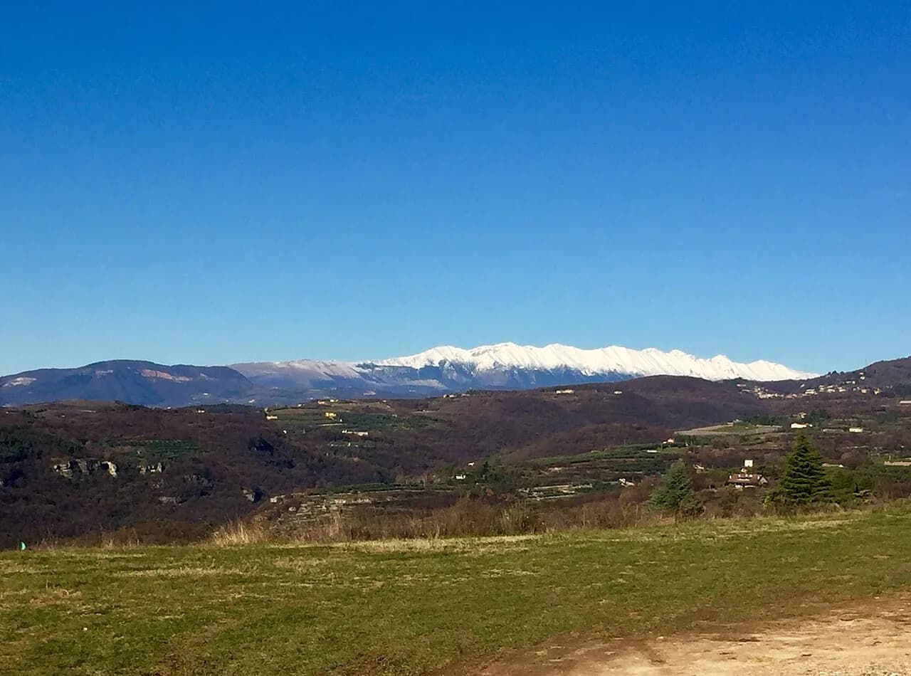
Geologically, the Torricelle form the southern tip of the Lessini Mountains, the range that continues north past Avesa and Quinzano. Hikers wanting more elevation can continue north into the marked trail network of the Lessini Mountains. Regional park status protects much of Lessinia's high pastures, an easy add-on for hikers who want a longer day beyond the Torricelle ridge. One numbered route, Trail 264A between Pigozzo and Maroni, extends the same landscape further from the city. Check current trail conditions and waymarking before adding that extension to a Torricelle day. To the east, Valpantena offers a quieter, less-visited valley for hikers who prefer solitude over vineyard scenery. Paved paths along the Adige River offer flat terrain instead of hills, right through the city center itself. Closer to town, two alternatives suit travelers who want hills without committing to a full hike. For similarly gentle terrain, Valpolicella's vineyard trails sit a short drive northwest. For waterside walking instead of hillside trails, the Sirmione and Lake Garda shoreline is the closer comparison. Both fit into a broader list of day trips from Verona if you have extra time.
Mistakes to Avoid on the Torricelle Trails
A few habits separate a smooth Torricelle outing from a frustrating one. Most problems come from underestimating a walk that starts inside a historic city center.
- Wearing flip-flops or smooth-soled shoes: several gravel stretches get steep and slippery, especially near the staircase and Avesa quarries.
- Skipping the sunset at Castel San Pietro: locals consider this the most rewarding hour on the whole hillside.
- Wandering off marked paths near villas: parts of the Torricelle are residential, and private driveways sit close to public trails.
- Assuming every route has fountains: pack water before you leave the lower streets.
- Treating the funicular as the only option: the parallel staircase is free and often faster once you count the wait.
Frequently Asked Questions
Why is the area called Torricelle?
That name comes from four cylindrical watchtowers the Austrian army built on the Santa Giuliana ridge between 1837 and 1843. They were originally visible from the city center, before denser vegetation grew in around them.
Can you reach the Torricelle by bus?
Yes. Local city buses serve stops near the Sanctuary of Our Lady of Lourdes and Opera Don Calabria. Most visitors still walk up from Ponte Pietra instead. Check current routes and timetables before relying on a specific line.
Is hiking the Torricelle safe for solo travelers?
The main routes near Castel San Pietro and the ramparts see steady foot traffic from local residents, students, and dog walkers throughout the day. Stick to marked paths and popular hours if you are hiking alone, especially on the quieter Avesa side.
How high do the Torricelle hills climb?
The highest point in the range reaches 318 meters, near Mount Ongarine above Avesa and Quinzano. Most day routes closer to the city stay well below that, in the 150 to 300 meter range.
Are the Maximilian Towers open to visitors?
No, the towers themselves are closed to the public, and one now holds antennas and repeaters. You can walk right past all four on the ridge trail and view them from the outside.
What is the best time of year to hike the Torricelle?
Spring suits wildflowers and mild temperatures, while autumn gives the clearest views back over the Adige. Midday in July and August runs hot with little shade, so plan an early morning or early evening start instead.
What should you pack for a Torricelle hike?
Sturdy shoes with grip handle the gravel and stone sections best, along with more water than a city walk requires. Layered clothing works better than a single heavy jacket, since temperatures swing between the shaded ramparts and the open ridge.
Can you combine a Torricelle hike with other Verona sightseeing?
Yes, many hikers pair the ramparts walk with a stop at Giardino Giusti, just below the trail near Opera Don Calabria. Borgo Trento, on the western side of the hills, works as an alternative base close to the Quinzano and Avesa trailheads.
Are dogs allowed on the Torricelle trails?
Yes, dog walkers are common on the ramparts and around Castel San Pietro. Keep dogs leashed near the working olive groves and vineyard terraces above Avesa, where trails cross private agricultural land.
Are the Torricelle trails officially waymarked?
Some sections carry standard hiking waymarks shared with the wider Lessini network, but not every path inside the city limits is signed. Carrying an offline map or a downloaded GPX track is the more reliable option near Avesa and Quinzano.
Continue exploring
More guides you'll find useful