Valle delle Ferriere Visitor Guide: Hiking from Amalfi
Plan a hike into the Valle delle Ferriere from Amalfi: trailheads at Pontone and Amalfi, loop options, reserve rules, and what to see along the way.
On this page
The Valle delle Ferriere is the green cut in the mountains directly above Amalfi, a place to trade beach crowds for streams, old factory ruins and shade. It sits inside the Parco Regionale dei Monti Lattari, and the walking connects the village of Pontone, a frazione of Scala, with Amalfi itself. One hiking source rates the classic Amalfi loop at 8.8 km with roughly 460 m of ascent, a moderate outing of about three hours and a quarter on the move, which is the single number worth fixing in your head before you plan the day.
Treat that figure as route data from a hiking platform, not an official timetable. Add time for photographs, water breaks and the slow sections where the path is rough or poorly marked, and assume a half day rather than a quick stroll. The walk is best treated as its own excursion, not something squeezed between a ferry and a lunch booking.
Where the Valley Sits and How the Walk Is Shaped
The reserve spreads across roughly 450 hectares on the slopes above Amalfi, with the River Canneto running through it and feeding the waterfalls and pools that give the valley its character. The two practical trailheads are Pontone, reached from Scala, and Amalfi itself, so you can walk it as a one-way descent or as a loop that brings you back to the coast. Distances between the villages are short on the map but steep underfoot, and the difference between starting high and starting low changes the whole feel of the day.
Think of the geography as two layers. The lower layer is Amalfi's historic paper-making district and the stepped lanes climbing out of town; the upper layer is forest, rock and water. Walking up from Amalfi means meeting the industrial layer first, while descending from Pontone puts the lemon terraces and valley views ahead of the ruins.
Choosing Your Route: the Amalfi Loop or the Harder Variant
The most-used option is the loop from Amalfi, measured at 8.81 km with 460 m of climbing in each direction and graded moderate. That grade assumes decent fitness and sure footing rather than technical skill, so it suits walkers who are comfortable on uneven stone and packed earth for several hours. Budget more than the moving time suggests, because heat and photo stops both slow the pace.
A second itinerary, labelled Ferriere Valley, runs 9.76 km with about 200 m of ascent and 840 m of descent and is graded hard, requiring good fitness, sturdy shoes and alpine-style surefootedness. The larger descent tells you it drops considerably over its length, which is punishing on knees and slower than the numbers imply. Choose it only if you already walk regularly in hill country and have checked the profile against your own comfort level.
A third, longer loop from Ravello via the paper-mill ruins and old aqueduct is recorded at 18 km with over 1,000 m of ascent and is also rated hard. It is a full-day proposition and easy to underestimate in warm weather. For most first-time visitors, the moderate Amalfi loop is the sensible default, with the harder variants reserved for a second visit or a fitter group.
Starting from Pontone: Ruins, Lemon Gardens and the Descent
Starting in Pontone means beginning high and walking down into Amalfi, which front-loads the views and leaves the climbing for the return, if you make one. From the small square you can pick out the ruins of the Church of Sant'Eustachio before heading toward the valley, passing lemon gardens and terraces with the town below. The early stretch is where the landscape opens up, so it rewards an unhurried start rather than a rush toward the water.
Once inside the reserve the sound of the Canneto takes over, and the path follows water through the wooded section before the long descent of steps into Amalfi. Those final stairs are the reason a descent is easier on the lungs but harder on the legs. If your knees complain on downhills, poles are worth packing for this direction.
Starting from Amalfi: Climbing Through the Paper District
Beginning in Amalfi reverses the logic: you climb first, through the lanes and past the traces of the paper mills that once used the river's force, and reach the valley proper with the hardest gradient already behind you. The steps that mark the end of the Pontone route become your starting gate. This direction suits walkers who prefer to gain height early and finish downhill into town, with a cold drink waiting at the bottom.
For the town itself, a separate Amalfi self-guided walk is a better use of an hour than trying to absorb the historic centre while tired. Keep the two activities on different halves of the day.
What You Actually See on the Trail
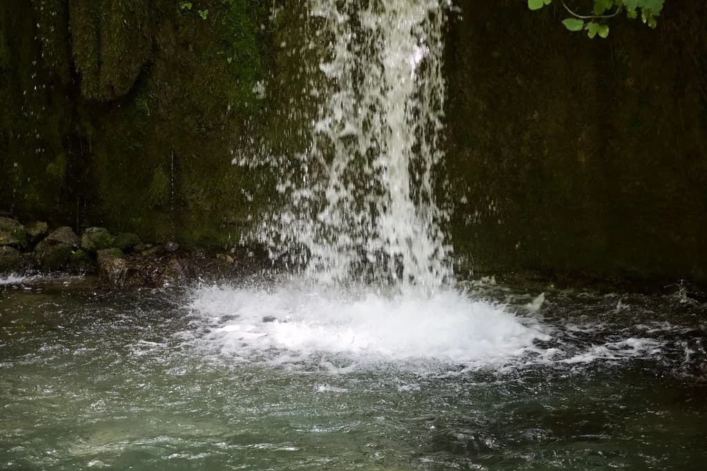
The Canneto creates small waterfalls, streams and natural pools throughout the valley, and in the hottest weeks it is common to see people bathing in them. The water is genuinely cold even in summer, so treat a dip as a shock to the system rather than a warm swim. Flow varies through the year, and reports from walkers describe thin water at times and a closed access point on one spring visit, so arrive without assuming a full cascade.
The valley's name comes from the ironworks that once operated here, producing nails for the boats of the Republic of Amalfi in the Middle Ages, and ruins of that industry now sit half-swallowed by vegetation. Along the way you also pass ancient paper factories, an aqueduct and the drying racks where sheets of Amalfi paper were laid out. Between the eleventh and twelfth centuries the same water powered mills for pasta production before they were converted to paper.
The result is a walk where industrial archaeology and woodland alternate every few hundred metres, which keeps the climb interesting. Look for the ruined structures under the greenery rather than expecting signposted monuments, since interpretation along the path is limited.
Rare Flora and Fauna to Watch For
The valley's south-facing position, sheltered from cold winds, has created a microclimate that supports the giant fern Woodwardia radicans, a species dating back to the Tertiary period. It shares emblem status with the spectacled salamander, and both are the symbols of the reserve. The same conditions also harbour the carnivorous plant Pinguicola hirtiflora, alongside a wider mix of lush vegetation and wildlife.
These are things to notice quietly rather than collect or handle. Stay on the path where it is defined, keep voices low near water, and accept that a spring walk may show leafless coppice and only a few early bloomers, as one hiker reported in early April.
Reserve Rules and Access: What to Confirm Before You Go
The reserve's core zone, including the main waterfall, has been described by visitors as requiring a pass or ticket obtainable in Amalfi, and at least one walker reported buying it at the zone entrance. This is a visitor account rather than a published rule, so do not build your day around it. Check the reserve's own site or ask locally in Amalfi before you set out, and carry a little flexibility if access turns out to be restricted.
No current entry fee, opening hours or seasonal closure dates are published in the material available here, so any figure you read elsewhere should be verified at source. Guided options also exist for the reserve, which can simplify access questions if you would rather not improvise. Treat any barrier or notice on the ground as final, whatever a blog says.
Water, Weather and Wayfinding Reality
Two things vary more than any guide admits: how much water is running and how easy the path is to follow. A July visitor found little water in the pools, and an April visitor reached a closed waterfall in the afternoon after finding the route poorly signposted in places. Plan for navigation rather than relying on painted marks, and carry an offline map on your phone.
Weather matters more here than on the coast path, because the valley is shaded, damp and steep. Rain makes the stone slick, and heat makes the climb harder than the distance suggests. Check a forecast the morning of your walk and be willing to swap the hike for a town day if conditions look poor.
Timing Your Walk Through the Year
Spring brings fresh greenery but also the risk of leafless woodland early in the season and, as reported, occasional closed access. Late spring is a reasonable compromise, with more water and more light than high summer. Autumn tends to offer steadier temperatures for climbing, though the water will be lower after a dry season.
Summer works if you start early and accept the cold pools as relief rather than a swimming session. The reserve is described as an alternative to crowded beaches in high season, which holds true mainly because the path spreads people out. Afternoons in July and August are best avoided for the exposed sections.
Practical Kit and Common Mistakes
Wear shoes with real tread, because much of the route is stone steps and packed earth that turn slippery when wet. Carry more water than you would for a coastal stroll, plus a layer for the shaded valley floor, and keep your phone charged for the offline map. Trekking poles help on the long descents of the harder variants.
The most common mistake is treating the walk as a short add-on. The moderate loop alone takes the better part of half a day once stops are included, and the harder routes take longer. The second mistake is assuming the waterfall will be running or the pools open; both depend on season and access, so build in alternatives.
Pairing the Hike with Amalfi, Scala and Ravello
Because the walk ends, or begins, in Amalfi, the town's sights fit naturally around it. The Museo della Carta Amalfi visitor guide covers the paper museum near the steps that close the Pontone route, making it a logical post-hike stop for anyone hooked on the valley's industrial history. Save it for after the walk rather than before, when your legs are fresh enough for the museum.
Up on the ridge, Pontone and Scala reward a slow hour, and Ravello is a short hop beyond for gardens and views. Back in town, the Amalfi old town lanes and the hidden gems in Amalfi around the Porta della Marina area suit an evening wander once the hiking boots are off. Keep the day's plan loose enough to allow for a late finish.
Plan Your Visit
The Valle delle Ferriere rewards walkers who treat it as a proper half-day outing with a map, water and realistic expectations. Pick the moderate Amalfi loop for a first visit, take the harder variants only with hill fitness and time to spare, and confirm access to the core zone locally before committing. For wider planning, see Amalfi Attractions: Visitor Guides to 7 Sights.
Go early, watch the forecast, and let the valley set the pace rather than a ferry timetable. The ruins, the ferns and the cold water are the point, and none of them improve when rushed.
Frequently Asked Questions
How do you hike the Valle delle Ferriere from Amalfi?
Start either in Amalfi and climb through the old paper-making district, or in Pontone, a village of Scala, and descend toward Amalfi. Both connect with the reserve's paths along the River Canneto. The Amalfi loop is measured at 8.8 km and graded moderate, so allow roughly half a day with stops. Carry an offline map, since signage is thin in places.
How long does the Valle delle Ferriere hike take?
Third-party route data puts the Amalfi loop at about 8.81 km with roughly 460 m of ascent, taking a little over three hours of moving time and graded moderate. Real visits run longer with photographs, water breaks and rough ground. The 9.76 km Ferriere Valley variant is graded hard and needs more time and fitness.
Do you need a pass or ticket to enter the valley?
Visitors have reported that the core zone, including the main waterfall, requires a pass obtainable in Amalfi, with one walker buying it at the zone entrance. That is not a published rule, so confirm with the reserve or locally in Amalfi before you rely on it. No current fee or opening hours are published in the material reviewed here.
Can you swim in the pools in the Valle delle Ferriere?
People do bathe in the natural pools during the hottest weeks, and the water is very cold even in summer. Flow varies, with reports of little water at times, and access to the waterfall area has been closed on at least one occasion. Treat any dip as optional and respect signs on the ground.
Is the Valle delle Ferriere hike suitable for beginners?
The moderate Amalfi loop suits walkers with reasonable fitness who are steady on uneven stone and steps, but it is not a flat stroll. The harder 9.76 km variant demands good fitness, sturdy shoes and alpine surefootedness. If you are new to hill walking, choose the moderate route and start early.
What is the best time of year to walk the Valle delle Ferriere?
Late spring and autumn give the most comfortable climbing temperatures, though spring can mean leafless woodland early on and summer can mean low water. In July and August, start early and avoid the exposed afternoon sections. Check the forecast on the day, since wet stone makes the steps slippery.
Where does the Pontone to Amalfi route start and finish?
The route begins at the small square in Pontone, where the ruins of the Church of Sant'Eustachio are visible, and ends in Amalfi at the long flight of steps below the valley. Walking it in reverse means climbing from Amalfi first and finishing downhill into Pontone.
Sources
Continue exploring
More guides you'll find useful