Water of Leith Walk: Complete Route & Segment Guide (2026)
Plan the water of leith walk with mileage, times and highlights for each segment, from Colinton Tunnel to the Gormley statues at Leith, updated for 2026.
On this page
Water of Leith Walk: A Segment-by-Segment Guide to Edinburgh's River Path
Last updated September 2026, this guide breaks the water of leith walk into three manageable sections, so you can match distance to the time you actually have. Balerno to Leith covers roughly 12.25 miles (19.7 km) along the river, though most visitors choose one stretch rather than the full route in a single day. Route sections below compare the rural start, the Dean Village and Stockbridge heart of the walk, and the urban finish at Leith, alongside bus links and accessibility notes.
The Water of Leith Walk: Route Overview
Edinburgh has two things called Leith Walk, and mixing them up is a common visitor mistake. One is a straight road running from the New Town down to Leith; the other is the Water of Leith Walkway, the riverside path this guide covers. This walkway follows the Water of Leith for about 12.25 miles (19.7 km) between Balerno and Leith, per the Water of Leith Conservation Trust. Roughly half a mile of the path runs on ordinary streets; the rest tracks the riverbank away from traffic. Cyclists and walkers share a surface of tarmac, compressed grit and earth, and horses are permitted on some stretches. Managed by the City of Edinburgh Council's Parks, Greenspace and Cemeteries team, the walkway was completed in 2002 with Millennium Project funding, per the Trust. An audio trail from the Trust adds spoken commentary at points along the route, useful if you'd rather listen than read a map. Because Balerno sits at the route's southwestern end, walking downstream toward Leith gives a gentle downhill grade the whole way. It's the direction most route guides recommend for an easier day. The walk also pairs well with other quiet routes away from the main sights; see our guide to lesser-known corners of the city for more options.
Choosing Your Section: A Distance-Based Guide
Most visitors pick a segment that matches their time and fitness, rather than tackle all 12.25 miles in one outing. The Trust splits the route into two working halves: Balerno to Slateford covers 5 miles in about 2 hours, while Slateford to Leith covers 7.5 miles in roughly 3 hours. Within that second half, Stockbridge to Leith alone runs about 3.5 miles and takes around 1 hour 20 minutes, making it a realistic finish for an afternoon that starts later in the day. Horse riders, cyclists and walkers all use parts of the route, per Condé Nast Traveler's review, though most people cover one leg rather than the full distance in a single visit. Between Balerno and Slateford, the path follows the dismantled Balerno railway line and forms part of National Cycle Route 75, popular with cyclists heading out of the city. That stretch also passes the sites of the old Currie and Juniper Green railway stations and Spylaw Park near Colinton, before the path ducks under the A720 city bypass and into the Colinton Tunnel. On the middle segment, the path crosses Saughton Park, skirts Murrayfield Stadium, home of Scottish rugby, and threads through Roseburn Park before reaching Dean Village. The urban finish passes Canonmills and Bonnington on its way to the Victoria Swing Bridge at Leith Docks, the walkway's official end point. Signposts mark the entire route, and it sees heavy use from both pedestrians and cyclists year-round.
| Segment | Distance | Time | Best For | Key Highlights |
|---|---|---|---|---|
| Balerno to Slateford | 5 miles (8 km) | About 2 hours | Nature lovers, cyclists | Colinton Tunnel mural, Colinton Dell, Craiglockhart Dell |
| Slateford to Stockbridge | About 4 miles (6.4 km) | Roughly 1 hr 40 min | First-time visitors, photographers | Water of Leith Visitor Centre, Dean Village, St Bernard's Well, Scottish National Gallery of Modern Art |
| Stockbridge to Leith | 3.5 miles (5.6 km) | About 1 hr 20 min | Foodies, art fans | Antony Gormley statues, The Shore |
Stockbridge to Dean Village: Short Loop or Longer Walk to the Galleries
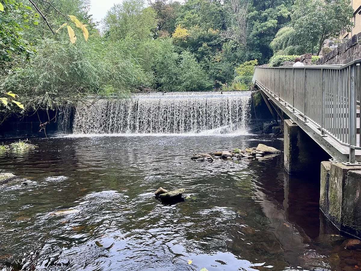
From Stockbridge, the short version of this stretch runs upstream past St Bernard's Well to Dean Village. It's a flat, paved walk under Dean Bridge, built by engineer Thomas Telford in 1833. This leg is easily reached from Edinburgh's city centre, according to Condé Nast Traveler's review of the route. Most walkers cover this section in under an hour. For the milling history behind the village, see the Dean Village guide. Continuing past Dean Village toward Roseburn adds a footbridge crossing near the Scottish National Gallery of Modern Art. That extends the walk into the roughly 2-mile stretch the Trust maps between Roseburn and Stockbridge. The longer option gets you closer to the first Antony Gormley statue. Check conditions before setting out: a landslip near Dean Path and Sunbury Bridge closed part of this stretch for a decade, reopening only in May 2022. Steep steps and narrow diversions around Dean Village can also affect wheelchair users or anyone pushing a pram.
Colinton Tunnel, St Bernard's Well and the Gormley Trail
Near the walk's western end, the path passes through the 460-foot (140-metre) Colinton Tunnel, a former railway tunnel now covered in a mural. Artist Chris Rutterford led the community project, inspired by Robert Louis Stevenson's poem From a Railway Carriage, with local volunteers and schoolchildren completing it in October 2020. It's often described as the largest mural of its kind in Scotland, based on coverage of the tunnel project. Further along near Dean Village, St Bernard's Well marks a natural spring discovered in 1760. Its neoclassical temple, designed by Alexander Nasmyth in 1789, uses Doric columns and a domed roof topped with a carved pineapple. Inside stands a statue of Hygieia, the Greek goddess of health. Antony Gormley's cast-iron figures, part of a series called 6 Times, stand in the river between the Scottish National Gallery of Modern Art and the sea at Leith. One figure stands outside the gallery, and the rest sit spaced along the water toward Leith. Some sit partly submerged, so look down into the current rather than only along the banks. The route is detailed by Forever Edinburgh.
Getting There, Getting Back and Trail Facilities
Lothian Buses route 44 runs to Balerno, the simplest way to reach the walk's southern end without a car. From Leith, Edinburgh Trams and several Lothian Buses services run back to the city centre, so there's no need to double back the way you came. Toilets and drinking water are limited along the route, so time a break around the Water of Leith Visitor Centre at Slateford, roughly the walk's midpoint. It sells the walkway map for £1.00 and has a small café for a mid-walk snack. If you'd rather not carry a paper map, a basic PDF version downloads free from the Trust's site, and Google Maps covers the trickier junctions once you're inside the city centre. Keep dogs on a lead and stay alert on narrower stretches near Colinton Dell, since cyclists share the same surface as walkers for the full 12.25 miles.
After 5 miles at Slateford, the Water of Leith Visitor Centre provides the route's midpoint stop with toilets, drinking water, and a café.
- Getting there: Lothian Buses route 44 to Balerno
- Getting back: Edinburgh Trams and Lothian Buses services from Leith
- Facilities: Water of Leith Visitor Centre at Slateford, with toilets, drinking water, a £1.00 walkway map and a small café
Food and Drink Along the River
Stockbridge marks the best sit-down break for anyone walking the middle section, with independent cafés and delis just off the path. Specific options are listed in the Stockbridge neighbourhood guide. At the Leith end, The Shore has seafood restaurants and pubs facing the water, a fitting finish after 3.5 miles from Stockbridge. Browse choices in the Leith neighbourhood guide before you set off, since some kitchens close between lunch and dinner service. Both neighbourhood ends get busy on weekends, so booking ahead helps if you want a specific restaurant after the walk. For a snack mid-route, the Water of Leith Visitor Centre café at Slateford covers the gap between the two ends.
Wildlife and Photography Along the Walk
The river corridor is designated an Urban Wildlife Site, and Forever Edinburgh highlights several species worth watching for along the banks. Founded in 1988, the Water of Leith Conservation Trust runs around 240 river clean-ups a year, per Forever Edinburgh. Autumn covers parts of the path in wet leaves, which makes some stretches slippery underfoot. Sightings of roe deer or even badgers are possible near the wooded dells, per Forever Edinburgh, though these are less predictable than birdlife. For photos, early morning light near St Bernard's Well and the bridge view over Dean Village tends to give the clearest results. Both spots face open water without heavy tree cover. Bring binoculars if wildlife-spotting is the goal, since sightings are opportunistic rather than guaranteed. Check the Trust's site for current sightings and closures before a dedicated wildlife trip.
- Kingfishers
- Herons
- Otters
- Brown trout
- Roe deer and badgers
- Wild garlic and orchids (spring)
Common Mistakes and Path Etiquette
Confusing this walkway with Leith Walk, the road linking the New Town to Leith, is the single most common planning mistake. They are different routes entirely, and following the wrong map adds miles to your day. Trail shoes matter more than the map: the Balerno and Colinton sections turn muddy after rain, since the surface there is compressed earth rather than tarmac. Wooded stretches through Colinton Dell and Craiglockhart Dell get dark early once autumn sets in, so plan a late-afternoon walk to finish before sunset rather than after it. Check the Trust's closure notices before you go. As of the Trust's latest update, the connecting bridge at Powderhall and St Marks Park remains closed, and rerouting adds time you may not have budgeted. If rain is forecast, save this walk for a drier day. So much of the surface is unpaved that it turns slick fast. Keep our rainy day itinerary as a backup instead. Follow the Trust's own Paths for Everyone code of conduct on shared sections. Keep dogs on a lead, watch for cyclists, and give way on narrow sections near the Dells.
Confusing Leith Walk (the road) with the 12.25 miles Water of Leith Walkway (the riverside path) is the most common planning error and could add unexpected miles to your day.
Frequently Asked Questions
How long does the Water of Leith Walk take?
It depends on the section. Trust mileage guides split the route into Balerno to Slateford, 5 miles in about 2 hours, and Slateford to Leith, 7.5 miles in roughly 3 hours. Walking the entire 12.25 miles (19.7 km) back to back takes most of a day with stops.
Is the Water of Leith Walk the same as Leith Walk?
No. Leith Walk is the road connecting the New Town to Leith, while the Water of Leith Walkway is the riverside footpath this guide covers. Confusing the two is a common visitor mistake, since both names sound similar.
Which section is best for a short visit?
Stockbridge to Dean Village is the shortest worthwhile stretch, covering St Bernard's Well and the milling-era buildings in under an hour on flat ground. Extending it toward Roseburn adds the Scottish National Gallery of Modern Art footbridge and the first Antony Gormley statue, if you have closer to two hours to spare.
Is the walkway accessible for wheelchairs and prams?
Slateford to Leith is generally the most accessible stretch of the route. Sections near Dean Village have steep steps and narrow diversions, so check current conditions before planning a wheelchair or pram route through that part.
Where do you see the Antony Gormley statues?
Cast-iron figures from Gormley's 6 Times series stand in the river between the Scottish National Gallery of Modern Art and the sea at Leith. Some sit partly submerged, so look down into the water rather than only along the banks.
Are dogs allowed, and are there toilets along the way?
Dogs are welcome on a lead, per Forever Edinburgh's own visitor tips. Toilets and refreshments are limited, so plan around the Water of Leith Visitor Centre at Slateford, roughly the route's midpoint.
Can you walk the whole 12.25 miles in one day?
Yes, but budget most of a day for it, since the two halves alone total roughly 5 hours of walking time before stops. Most people pick one or two segments instead, especially if photography or wildlife-spotting will slow the pace.
Continue exploring
More guides you'll find useful